Port Of Paradip Seaport - India Information And Characteristics Port Information
| No | Ship Name/MMSI/IMO | Type | Year | Previous | Next | Size | formattedETA | GT | DW | SA | A2 | Country | tlck |
|---|
| No | Ship Name/MMSI/IMO | Type | Year | Previous | Next | Size | formattedETA | GT | DW | SA | A2 | Country | tlck |
|---|
| No | Ship Name/MMSI/IMO | Type | Year | Previous | Next | Size | formattedETA | GT | DW | SA | A2 | Country | tlck |
|---|
| No | Ship Name/MMSI/IMO | Type | Year | Previous | Next | Size | formattedETA | GT | DW | SA | A2 | Country | tlck |
|---|
NOTE: ALL Paradip Port FIGURES ARE ABOUT, VESSEL MOVEMENT PLANS ARE TENTATIVE AND SUBJECT TO CHANGE DEPENDING ON PORT’S DECISION OF ALLOTMENT OF BERTHS
Paradip Seaport - India Vessel Schedule by Port and Arrivals, Departures, Expected vessels
Find the Paradip Seaport - India vessel Line up & Schedule by port. Live ship tracking and vessel position like Berth, Anchorage, sailed, expected arrival departure and many more. Ruzave freight forwarders Directory will help you out to get Detailed information for Port of Paradip Seaport - India Real-time data for recent ship arrivals and departures, ships in port and scheduled vessel arrivals at Paradip Seaport - India Looking for freight forwarders, shipping & marine companies in Paradip Seaport - India? Ruzave invented shipping directory or international freight forwarders directory where you can find your easy way and best freight forwarders, maritime service companies at Paradip Seaport - India, port and vessel line information at Paradip Seaport - India for your business.
Upload Image
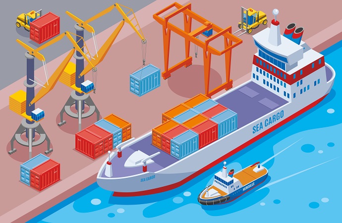
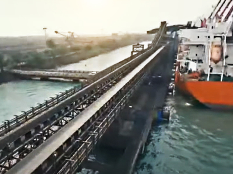
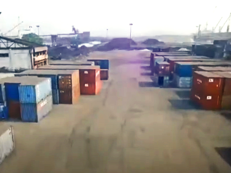
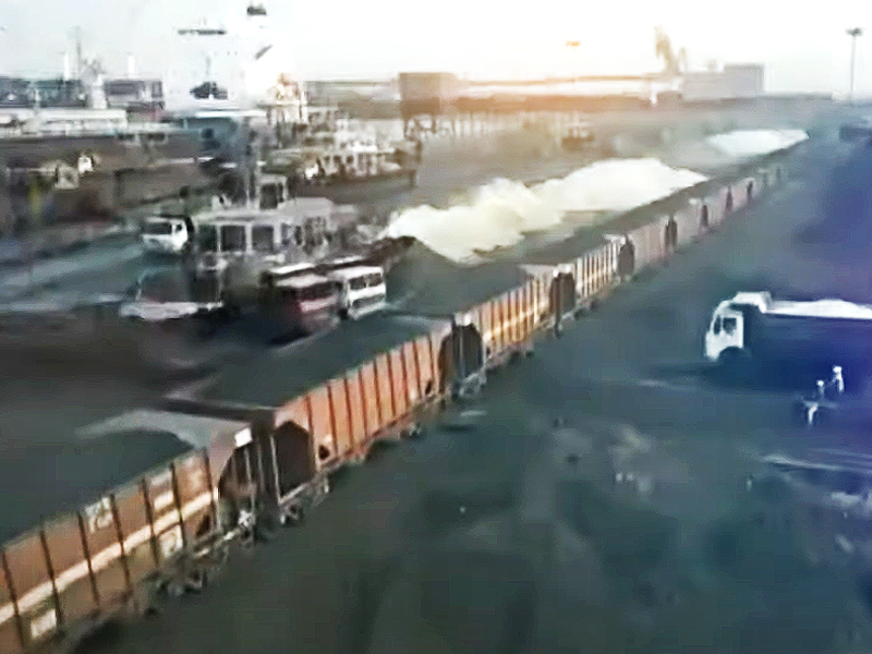
Paradip Port is located in Odisha State, India as one of major Port of India. Paradip Port Handle cargo like Crude Oil, POL products, Iron Ore, Thermal Coal, Chrome Ore, Coking Coal, Manganese Ore, Charge Chrome, Ferro Chrome, Ferro Manganese, Limestone, Hard Coke, Ingots and Moulds, Billets, Finished Steel, Scrap, Fertilizer, Fertilizer Raw Material, Clinker, Gypsum, Project Cargo and Containers. The Port is now equipped with 16 (sixteen) berths, 3 (three) Single Point Moorings (SPM), 1 (one) Ro-Ro Jetty, a well maintained Approach and Entrance Channel having 17.1 Mtrs minimum depth to handle a wide range of vessels up to maximum LOA of 260 Mtrs.

Paradip Port is located in Odisha State, India as one of major Port of India. Paradip Port Handle cargo like Crude Oil, POL products, Iron Ore, Thermal Coal, Chrome Ore, Coking Coal, Manganese Ore, Charge Chrome, Ferro Chrome, Ferro Manganese, Limestone, Hard Coke, Ingots and Moulds, Billets, Finished Steel, Scrap, Fertilizer, Fertilizer Raw Material, Clinker, Gypsum, Project Cargo and Containers. The Port is now equipped with 16 (sixteen) berths, 3 (three) Single Point Moorings (SPM), 1 (one) Ro-Ro Jetty, a well maintained Approach and Entrance Channel having 17.1 Mtrs minimum depth to handle a wide range of vessels up to maximum LOA of 260 Mtrs.
Details latest Port information Paradip Port
Port
Paradip Trust Seaport
UN Locator Code
INPRT
Location
Paradip port is strategically situated at mid-point between 210 nautical miles south of Kolkata and 260 nautical miles north of Visakhapatnam.
Latitude 20° - 15' - 55.44" N
Longitude 86° - 40' - 27.34" E
Anchorage Area
A)GENERAL ANCHORAGE POSITION : As area covered by limiting circle with center on latitude - 20 - 11.5' N, longitude - 86 - 42' E and radius of 0.75 NM.
B) TANKER ANCHORAGE POSITION : As area covered by the limiting circle with center on latitude 20 - 11.5' N, longitude 86 - 45' E and radius of 0.75 NM.
The Port of Paradip has an artificial lagoon type harbour protected by 2 (two) rubble mound “Break Waters” and approached by the dredged channel. The North Break Water is 538 mtrs long on the North-Eastern side of the Port and the South Break Water is 1217 mtrs long on the South-Eastern side.
The position of the Channels inside the harbour is as under:
Approach Channel
10.00 km Long
300.00 mtrs Wide
18.70 mtrs Deep
Entrance Channel
2000.00 mtrs Long
240.00 mtrs Wide
17.10 mtrs Deep
Turning Basin
520.00 mtrs. Diameter
17.10 mtrs Deep
Pilot boarding
The Pilotage is compulsory for all vessels above 200 MTs Gross Tonnage.
The Pilot Boarding ground is about 3 miles SE of Breakwaters. .
The distance from shore is about 3 miles.
The Pilotage service is available to all vessels during 24 hours and 365 days. All the vessels have to inform their ETA prior to entering the Port Limits to the Port Signal Station on VHF Channel: 16 / 06. Pilot Launches having speed more than 10 knots, 02 Nos. pilot lunches having speed of 7 knots and 02 Nos. Mooring Boats are also available for passing the Mooring Lines to the Berth / Jetty.
Maneuvering time from Anchorage to Berth
Anchorage to Berth 30 minutes to 1 Hrs maximum.
VHF Channel Number
VHF-16 & 69,
Email at (signalstation.ppt@gmail.com)
Water Density
Dock Water density inside port is varying from 1.015-1.018.
Weather
Rainy season from mid-June to October. Moderate rainfall. Occasional cyclonic weather during this period. October to June weather remains sunny and dry.
BA Charts required
BA chart no. 538 ( Approach to paradip)
Stevedoring Working Hrs
0600 HRS TO 1400 HRS (RECESS 1100 HRS TO 1130 HRS)
1400 HRS TO 2200 HRS (RECESS 1900 HRS TO 1930 HRS)
2200 HRS TO 0600 HRS (RECESS 0300 HRS TO 0330 HRS)
Tide
Maximum Tide: 3.50 mtrs m
Minimum Tide: 0.40 mtrs
(Tideable Port)
Discharge Facility
1) Shore crane available.
Vessel Age Permitted
25 Years & subject to class approved by DG SHIPPING.
Minimum Crane Outreach
1) Min Vessel crane outreach should be 08.50 MTRS as per Port requirement.
2) Vessel gear should be minimum 20/25 SWL Capacity if discharge by ship's gear.
Ship Security
ISPS Level:
Police Boat: No
Night Navigation
Night navigation allowed?: No
Day Navigation Restriction
Vessel husbandry services & general information
medical facility for crew: Yes
Bunker supply: Yes
Ship supply: Yes
Fresh water supply: Yes
Garbage removal facility: Yes
Sludge removal facility: Yes
Repairing workshop availability: Yes
Sign On-Off permitted: Yes
Nearest International Airport:
Distance KM from port :
Nearest Domestic Airport:
Distance KM from port :
Ship sanitation certificate renewal: Yes
Port equipment information
Shore crane: Yes
Shore grab: Yes
Forklift: Yes
Container Lifter: Yes
Warehouse & Open Storege
Covered Warehouse Area: Yes
Open Storage Area: Yes
Cargo Connectivity
Land: Yes
Rail: Yes
Dry Docking
Dry Docking Available: Yes
Note : The Port Information, Restrictions updated are current & and can be changed without any prior intimation by authority. We shall not be responsible for any.
Terminal Details and information of Paradip Port
| Shore Crane | |||||||
|---|---|---|---|---|---|---|---|
| Berth No | LOA(Mrts) | Beam(Mtrs) | Draft(Mtrs) | DWT | Qty | SWL | Cargo Handled |
| Dry Cargo Terminal | |||||||
| Iron Ore Berth | 260 | 38 | 13 | - | - | - | IRON ORE - Load Rate abt 20000 MT Per Day |
| EQ-1 | 260 | 38 | 11 | - | - | - | Coal |
| EQ-2 | 260 | 38 | 11.5 | - | - | - | Coal |
| EQ-3 | 230 | 33 | 12.50 | - | - | - | Coal |
| SQ | 230 | 43 | 12.50 | - | - | - | Iron Ore Fines, Coal |
| CQ-1 | 260 | 43 | 14.50 | - | - | - | Coal |
| CQ-2 | 230 | 33 | 14.50 | - | - | - | Coal |
| CQ-3 | 260 | 43 | 14.50 | - | - | - | Coal |
| Coal Berth I | 260 | 38 | 14.50 | - | - | - | Coal |
| Coal Berth II | 260 | 33 | 14.50 | - | - | - | Coal |
| Fertilizer Berth 1 | 230 | 33 | 14.50 | - | - | - | Fertilizer |
| Fertilizer Berth 2 | 230 | 33 | 14.50 | - | - | - | Fertilizer |
| MPB (Multi Berth) | 230 | 33 | 14.50 | - | - | - | Coal |
| Liquid Cargo Terminal | |||||||
| Container Terminal | |||||||
Note : The Port Information, Restrictions updated are current & and can be changed without any prior intimation by authority. We shall not be responsible for any.
NOTE: ALL FIGURES ARE ABOUT, VESSEL MOVEMENT PLANS ARE TENTATIVE AND SUBJECT TO CHANGE DEPENDING ON PORT’S DECISION OF ALLOTMENT OF BERTHS
VESSEL WORKING AT BERTH
| VESSELS AT BERTH | ||||||||
| Dated : 01.01.2026 | ||||||||
|---|---|---|---|---|---|---|---|---|
| SR.NO | NOMINATED BERTH | VESSEL NAME | ARRIVED | ETB | ETC/D | CARGO | QUANTITY | OPERATION |
| 1 | BERTH NO.2 - NIOB | MV OCEAN TIANBAO | 1918/27.12.25 | 31.12.25 | 01.01.26 | IRON ORE FINES | 62000 | EXP |
| 2 | BERTH NO.3 - KICT | MV NOVA CAELI | 1318/28.12.25 | 30.12.25 | 01.01.26 | C COAL / PCI COAL | 42000 | IMP |
| 3 | BERTH NO.4 - IOB | MV GREY LUNA | 2354/29.12.25 | 30.12.25 | 01.01.26 | IRON ORE FINES | 55150 | EXP |
| 4 | BERTH NO.5 - CB 1 | MV YC AEQUER | 2136/31.12.25 | 31.12.25 | 02.01.26 | TH COAL | 56075 | EXP |
| 5 | BERTH NO.6 - CB 2 | MV CAPE GRECO | 0048/ 01.01.26 | 01.01.26 | 02.01.26 | TH COAL | 75350 | EXP |
| 6 | BERTH NO.9 - EQ I | VACANT | ||||||
| 7 | BERTH NO.8 - EQ II | MV CHOLA SERENITY | 0354/31.12.25 | 31.12.25 | 01.13.26 | TH COAL | 76600 | EXP |
| 8 | BERTH NO.7 - EQ III | VACANT | ||||||
| 9 | BERTH NO.10 - SQ | MV SAFE COURSE | 1248/27.12.25 | 29.12.25 | 03.01.26 | A. NITRATE | 22,055 | IMP |
| 10 | BERTH NO.11 - CQ I | MV GLORIA CONFIDENCE | 1242/30.12.25 | 31.12.25 | 03.01.26 | IRON ORE FINES | 60750 | EXP |
| 11 | BERTH NO.12 - CQ II | MV ANATOLI | 2130/27.12.25 | 30.12.25 | 02.01.26 | IRON ORE FINES | 61750 | EXP |
| 12 | BERTH NO.13 - CQ III | MV FJ FRESIA | 2040/30.12.25 | 31.12.25 | 01.01.26 | IRON ORE PELLET | 78900 | EXP |
| 13 | BERTH NO.14 - MPB | MV ROSTRUM HAMBURG | 0900/23.12.25 | 31.12.25 | 04.01.26 | A NITRATE | 22,058 | IMP |
| 14 | BERTH NO.15 - FB I | MV TOMINY PROSPERITY | 2154/29.12.25 | 29.12.25 | 01.01.26 | ROCK PHOSPHATE | 61000 | IMP |
| 15 | BERTH NO.15 - FB II | MV MDS SOFIA | 0200/27.12.25 | 01.01.26 | 03.01.26 | SULPHUR | 35500 | IMP |
| 16 | BERTH NO.17 - PICT I | MV SUPRA PASHA | 0818/24.12.25 | 29.12.25 | 02.01.26 | HR COIL / STEEL PLATE | 36,612 | EXP |
| 17 | BERTH NO.17 - PICT II | VACANT | ||||||
| 18 | NQ I | VACANT | ||||||
| 19 | NQ II | VACANT | ||||||
| 20 | NQ III | VACANT | ||||||
| 21 | NDC | VACANT | ||||||
| WAITING VESSELS FOR MPB, CQ I, CQ II, SQ & KICT (GENERAL CARGO & KICT) | ||||||||
| SR.NO | NOMINATED BERTH | VESSEL NAME | ARRIVED | ETB | ETC/D | CARGO | QUANTITY | OPERATION |
| 1 | KICT | MV EDWARED N ( KICT ) | 0244/31.12.25 | 01.01.26 | 03.01.26 | S .COAL ` | 149213 | IMP |
| EXPECTED VESSELS FOR MPB, CQ I, CQ II, SQ & KICT (GENERAL CARGO & KICT) | ||||||||
| SR.NO | NOMINATED BERTH | VESSEL NAME | ETA | ETB | ETC/D | CARGO | QUANTITY | OPERATION |
| 1 | SQ | MV YUE DIAN 102 | 2330/01.01.26 | 01.01.26 | 04.01.26 | S COAL | 43477 | IMP |
| 2 | MT STDR GLORIA( KICT ) | 1500/02.01.26 | 03.01.26 | 05.01.26 | C COAL | 82500 | IMP | |
| 3 | MV PEDHOULAS CEDRUS | 0200/03.01.26 | 03.01.26 | 05.01.26 | C COAL | 44000 | IMP | |
| 4 | MV LILA TOKYO | 0300/03.01.26 | 03.01.26 | 05.01.26 | LIME STONE | 40000 | IMP | |
| 5 | MV LACERTA ( KICT ) | 1200/03.01.26 | 05.01.26 | 06.01.26 | C COAL | 47000 | IMP | |
| WAITING VESSELS (PICT) | ||||||||
| SR.NO | NOMINATED BERTH | VESSEL NAME | ARRIVED | ETB | ETC/D | CARGO | QUANTITY | OPERATION |
| 1 | NIL | |||||||
| EXPECTED VESSELS (PICT) | ||||||||
| SR.NO | NOMINATED BERTH | VESSEL NAME | ETA | ETB | ETC/D | CARGO | QUANTITY | OPERATION |
| 1 | MV NEMRUT BAY | 1800/02.01.26 | 02.01.26 | 05.01.26 | STEEL SLAB | 30000 | EXP | |
| 2 | MV SSL THAMIRABARANI | 1800/04.01.26 | 04.01.26 | 05.01.26 | CONTAINOR | 2930 | EXP | |
| 3 | MV XIU YU HAI | 0600/07.01.26 | 07.01.26 | 10.01.26 | STEEL SLAB | 25069 | IMP | |
| 4 | MV MSC ALIZE III | 1800/09.01.2026 | 09.01.26 | 10.01.26 | CONTAINOR | 550 | EXP | |
| WAITING VESSELS FOR CB I, CB II, EQ I, EQ II & EQ III (THERMAL COAL) | ||||||||
| SR.NO | NOMINATED BERTH | VESSEL NAME | ARRIVED | ETB | ETC/D | CARGO | QUANTITY | OPERATION |
| 1 | NIL | |||||||
| EXPECTED VESSELS FOR CB I, CB II, EQ I, EQ II & EQ III (THERMAL COAL) | ||||||||
| SR.NO | NOMINATED BERTH | VESSEL NAME | ETA | ETB | ETC/D | CARGO | QUANTITY | OPERATION |
| 1 | CB-1 | MV JAL KUMUD | 1300/01.12.25 | 02.01.26 | 03.01.26 | TH COAL | 65000 | EXP |
| 2 | EQ-2 | MV CHOLA PROSPERITY | 0600/02.01.26 | 02.01.26 | 03.01.26 | TH COAL | 75000 | EXP |
| 3 | MV RIPLEY PROGRESS | 1600/02.01.26 | 02.01.26 | 03.01.26 | TH COAL | 75000 | EXP | |
| 4 | MV MALENA | 1800/03.01.26 | 03.01.26 | 04.01.26 | TH COAL | 75000 | EXP | |
| 5 | MV DECCAN PRIDE | 0600/04.01.26 | 04.01.26 | 05.01.26 | TH COAL | 74000 | EXP | |
| WAITING VESSELS FOR IOB, NIOB & CQ III (IRON ORE FINES & IRON ONE PELLETS) | ||||||||
| SR.NO | NOMINATED BERTH | VESSEL NAME | ETA | ETB | ETC/D | CARGO | QUANTITY | OPERATION |
| 1 | NIOB | MV DUBAI SUN ( NIOB ) | 1718/29.12.25 | 01.01.26 | 02.01.26 | IRON ORE PELLET | 60000 | EXP |
| 2 | MV DESERT VICTORY ( NIOB) | 2358/30.12.25 | 02.01.26 | 03.01.26 | IRON ORE FINES | 52000 | EXP | |
| 3 | IOB | MV WADI FERAN ( IOB ) | 1655/31.12.25 | 01.01.26 | 03.01.26 | IRON ORE FINES | 57000 | EXP |
| 4 | MV SOLIN ( NIOB ) | 1730/31.12.25 | 03.01.26 | 04.01.26 | IRON ORE FINES | 55000 | EXP | |
| EXPECTED VESSELS FOR IOB, NIOB & CQ III (IRON ORE FINES & IRON ONE PELLETS) | ||||||||
| SR.NO | NOMINATED BERTH | VESSEL NAME | ETA | ETB | ETC/D | CARGO | QUANTITY | OPERATION |
| 1 | MV ALFIOS ( IOB ) | 0600/02.12.26 | 03.01.26 | 05.01.26 | IRON ORE FINES | 55600 | EXP | |
| 2 | MV EV MAR ( CQ-3 ) | 0600/04.12.26 | 04.01.26 | 05.01.26 | IRON ORE PELLET | 75000 | EXP | |
| 3 | MV WADI ALBOSTAN ( NIOB ) | 1000/06.12.26 | 06.01.26 | 07.01.26 | IRON ORE FINES | 55000 | EXP | |
| WAITING VESSELS FOR FB I & FB II (PPL & IFFCO) | ||||||||
| SR.NO | NOMINATED BERTH | VESSEL NAME | ETA | ETB | ETC/D | CARGO | QUANTITY | OPERATION |
| 1 | MV THE PATRON | 2330/24.12.25 | 29.12.25 | 04.01.26 | ROCK PHOSPHATE | 75725 | IMP | |
| 2 | MV GUO HAI LIAN 665 | 1118/31.12.25 | 04.01.26 | 07.01.26 | ROCK PHOSPHATE | 73620 | IMP | |
| EXPECTED VESSELS FOR FB I & FB II (PPL & IFFCO) | ||||||||
| SR.NO | NOMINATED BERTH | VESSEL NAME | ETA | ETB | ETC/D | CARGO | QUANTITY | OPERATION |
| 1 | MV GRECO LIBRO | 1200/01.01.26 | 01.01.26 | 04.01.26 | ROCK PHOSPHATE | 55000 | IMP |
Companies

Sky International
- Import-export Warehouse
- Fcl Sea Freight Forwarding
- Custom Clearance Agency

Leo Global Logistics India Pvt Ltd
- International Air Cargo Freight
- Fcl Sea Freight Forwarding
- Custom Clearing Services

Ismail Stores Supply
- Provision Store Supplier
- Safety Equipment Store Supplier
- Deck Store Supplier

Airlinks Cargo Pvt. Ltd.
- Sea Freight Forwarding
- Custom Clearing Services

Sree Sai Prasanna Services
- Electric Store Supplier
- Cabin Store Supplier
- Deck Store Supplier

Vista Marine Services
- Cargo Survey (pre-shipment, Load & Unload)
- Intermediate Bunker Survey
- On Hire & Off Hire Bunker & Condition Survey
Nautilus Shipping
- Crew Management
- Technical Management
- Ship Management

Amar Marine Enterprises
- Ship Chandler
- Fabrication
- Ship Repair

Holdchem Marine International
- Cargo Hold Chemical
- Chemical Applicator Set
- Provision Store Supplier
Aquatic Ship Care
- Gas Detectors Calibration
- Fire Fighting Services
- Electric Motor Repair

Seaship Logistics Private Limited
- International Air Cargo Freight
- Sea Freight Forwarding
- Ftl - Full Truck Load Services

Sea-wings Logistics Pvt Ltd
- Custom Clearing Services
- International Air Cargo Freight
- Ltl - Less Truck Load Services
Swen Container Line
- Sea Freight Forwarding

Five Star Logistics Private Ltd
- Custom Clearance Services
- Warehouse Covered
- Sea Freight Forwarding
Balaji Marine Services
- Vlsfo
- Deck Store Supplier
- Engine Spares
Navios International Marine Supply
- Provision
- Deck Stores

Network Shipping Services
- Cabin Store Supplier
- Bond Store Supplier
- Safety Equipment Store Supplier

Pragati Maritime Pvt. Ltd.
- Custom Clearing Services
- Air Cargo Freight
- Sea Freight Forwarding
Res Trans Logis
- Freight Forwarding
- Custom Clearance Services
- Dry Bulk Cargo Handling

Seaways Shipping And Logistics Ltd.
- Project & Heavylift Stevedoring
- Nvocc Liner Agency
- Port Agency

Atlas Shipping Services Pvt. Ltd.
- Custom Clearing Services
Seaworld Maritime
- Provision Store Supplier
- Engine Spares
- Engine Store Supplier

Dewpoint Shipping & Services Pvt. Ltd
- Chemical Oil Logistic
- P&i Insurance
- Dry Cargo Operating
Safetech Industrial & Marine Services
- Container Repairing
- Ship Survey
- Ship Chandler

Zeeshan Ship Supplies
- Cabin Store Supplier
- Provision
- Deck & Engine
.png)
V-ocean Shipping Pvt Ltd.
- Husbandry Agency
- Owner Agency
- Crew Tug

Uvm Shipping Services Pvt. Ltd
- Customs Clearance
- Air Fright Forwarding
- Project Handling
Omega Marine Services
- Tank Cleaning & Squeezing
- Sludge Disposal / De-sludge Services

Modern Shipping & Clearing Agency
- Custom Clearing Services
- Fcl Sea Freight Forwarding
- Sea Freight Forwarding
Zn Global Marine
- Engine Store Supplier
- Steel Repairs
- Electric Motor Repair

Progressive Offshore And Marine Services Llp
- Ship Chandler
- Electric Motor Repair
- Rig And Support Maintenance

Exim Logistics Pvt. Ltd.
- Custom Clearing Services
- Domestic Air Cargo Freight
Globe Maritime
- Electronic Repair
- Fire Fighting & Life Safety Equipment
- Engine Spares
Transocean Cargo Services Pvt Ltd
- Custom Clearing Services
- Rail Logistic
- Nvocc Liner Services

Total Shipping And Logistics Services
- Custom Clearing Services
- International Air Cargo Freight
- Fcl Sea Freight Forwarding
Port Information and Characteristics of Paradip Seaport - India
Detailed information about Port of Paradip Seaport - India. Know the Information and Characteristics about Paradip Seaport - India: port location, Paradip Seaport - India harbor characteristics, Paradip Seaport - India water depth, Paradip Seaport - India port services, restrictions, Terminal Details etc
POST INQUIRY FORM
Status
Sending RFQ...
Share with us, how do you feel about us!
Login to RUZAVE and access your Profile
Forgot password ?
Please enter your registered email
Membership Inquiry
Submit Your details
Banner Inquiry
Submit Your details

 All Categories



.png)